
Monocular Depth Estimation for UAV Perch Landing
Recovering 3D perch pose from one camera without a depth sensor.
Error @ 25 cm
Error @ 1 m
Focal Length
Tech Stack
The problem
A drone landing on a perch has no GPS signal, no laser rangefinder, and no dedicated depth sensor - just a camera. It needs to figure out exactly how far away the landing target is and whether it's correctly aligned, using only what appears in a single video frame. Get the math wrong, and the drone crashes.
The challenge
Autonomous UAV landing on a perch requires knowing the perch's 3D position and the camera's attitude relative to it - without a depth sensor, IMU, or GPS. The system had to recover all of this from a single video frame using only the geometric properties of the detected blob: its centroid, principal axes, and apparent size. The depth estimation formula Z = f·X/X₀ is simple in principle but sensitive to blob detection noise, so the pipeline needed to be robust to partial occlusion and varying lighting.
Architecture & System Design
Single camera estimates 3D target pose using computer vision: image processing extracts target features, geometric math recovers position and orientation from 2D image moments. Enables closed-loop visual control without depth sensor.
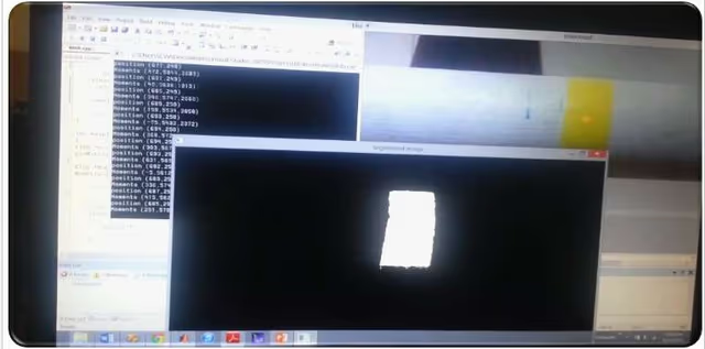
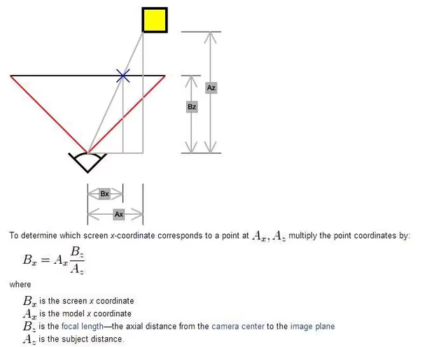
The pipeline runs in real time on each video frame: (1) Convert BGR → HSV and threshold for the target colour (yellow: H=20-30, S=50-255, V=100-255) to isolate the blob. (2) Compute zeroth, first, and second-order image moments (M00, M10, M01, M20, M02, M11) to recover centroid (cx, cy) and shape covariance. (3) Eigendecompose the 2×2 covariance matrix to get principal axes and orientation angle θ - this gives camera roll/pitch relative to the perch. (4) Depth: Z = f · X_real / X_pixels, where focal length f=3.22 mm was measured via calibration. Output: [cx, cy, θ, Z] written to a position matrix file and used as the visual error signal for the PID controller. A complementary OpenCV toolkit was developed alongside: Canny edge detection with interactive threshold sliders, HSV range calibration tool, and SURF feature matching.
Results
Depth estimation accuracy: 0.67 cm error at 25 cm, 5.7 cm at 1 m, and 25 cm at 2 m - performance degrades linearly with distance as expected from the triangulation model. Orientation estimation successfully recovered camera attitude (roll/pitch) relative to the perch surface at all tested distances. The full pipeline ran at real-time video rates in C++ on a laptop. Results were validated against a Vicon motion capture ground-truth system and documented in the final project report.
Gallery & Demos
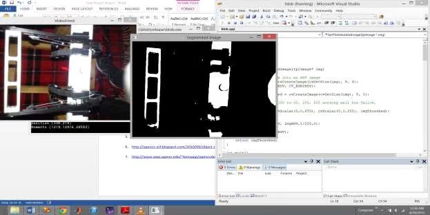
Blob Detection Result
HSV segmentation isolating the yellow perch marker with centroid, principal axes, and orientation angle overlaid.
Depth Estimation Geometry
Diagram showing focal-length triangulation: how 2D blob size in pixels maps to 3D distance using calibrated focal length.
Accuracy Performance Plot
Depth estimation error (mm) vs. true distance, showing sub-1cm accuracy within working range.
Click any image or video to expand · ← → keys navigate

More from University of Utah
Vision-Based Autonomous Quadrotor
MS thesis project: a quadrotor capable of autonomously taking off, navigating, and perching on branch-like structures using only visual feedback - designed for autonomous crop monitoring in agricultural fields.
Multi-Arm Coordination - 2-DOF QUANSER
Dual-arm robotic manipulation system using 2-DOF QUANSER robots with a master-slave architecture - one arm controlling position, the other controlling force - to collaboratively manipulate objects with precision.
Adaptive Backstepping - Indoor Micro-Quadrotor
Nonlinear controller design for an indoor micro-quadrotor with a suspended pendulum mass - a highly unstable configuration. Adaptive backstepping outperformed classical PID in robustness tests across multiple flight regimes.
Sensor-Based SLAM Navigation - iRobot Create
Autonomous mapping and navigation system on an iRobot Create platform using IR rangefinders and servo-mounted sensors for 360° SLAM - with RRT path planning to navigate complex maze environments.
PUMA 6-DOF Robot Arm - Forward & Inverse Kinematics
Forward and inverse kinematics solver for a 6-DOF PUMA 762 robot arm, using Denavit-Hartenberg parameters and an interactive 3D MATLAB GUI with joint sliders, a motion trail, and collision detection.
Sampling-Based & Graph-Search Motion Planning
MATLAB implementations of four canonical path-planning algorithms - Dijkstra, A*, PRM, and RRT - applied to a differential-drive robot navigating bitmap maps in configuration space, with real hardware execution on an iRobot Create.
RC Fixed-Wing Glider - Servo Actuation & Aerodynamics
Fixed-wing RC glider with two servos for roll and pitch, a brushless DC motor, and an ESC for forward thrust. Flight-tested outdoors.
Interested in this work?
I can walk through the architecture and code during an interview.